How to view event information
INDOT’s 511 Traveler Information website is provided to assist motorists in their decision making on Indiana roadways. Icons on the map represent unplanned traffic events, planned construction, weather events, road conditions, traffic speed information, etc. that could have an impact on travel. Clicking on an icon will display the details of the event at the bottom of the web page.
Tour this featureView an event or device using the map
- Navigate using the map to find events or reports of interest.
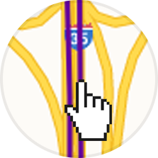
- Click or tap the event (e.g.
,
,
), road condition segment (e.g.
 ), or device icon (e.g.
 ).
- Optionally, hover your mouse over the event, road segment, or device icon to view a short description.
- The map will highlight the selected event, road segment, or device, and the details will appear at the left of the screen (on phones and tablets the details will display on the bottom of the screen).
Event priority levels
Each event is given a priority level from low to high which indicates its impact on traffic.
Lane Closure Low priority events have a minor impact on traffic and are displayed with a smaller icon.
Lane Closure High priority events have a greater impact on traffic and are displayed with a larger icon.
Critical Disruption Events with a “Critical Disruption” halo indicate the highest level of priority events and contain critical information for travelers
View more event details on phones or tablets
- tap the button to bring the content detail view to the top of the page.
- Use a
swipe down gestureor the browser scrollbar to scroll down.
Minimize event details on phones or tablets
- Tap the button to bring the content detail view to the bottom of the page.
- Use a
swipe up gestureor the browser scrollbar to scroll up.